Combined risk analysis, methods and analytical tools are key to managing forest fires
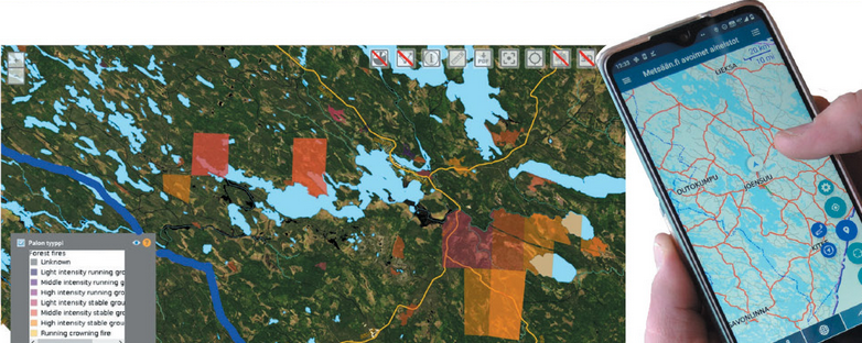
Even though active fire suppression limits large-scale fires, fire flights and mapping of potential risk areas can help early detection and preparedness.
The aim of Biokarelia project is to develop practical tools for biodiversity hotspots preservation. This is done by mapping biodiversity values, monitoring and forecasting occurrence of forest fires and wood harvesting along the Russian-Finnish border.
Last year during the summer, 27 drone flights were made in 12 different sites across North Karelia. These included Petkeljärvi and Koli National Park areas. Data is also being collected from Russian side of the border by our partners. This will continue again this summer.
-Why are these flights done, how are the results developed and why are these activities necessary-
Read more in recently released North Karelia Biosphere Reserve's Kaarna newsletter.
You can also get updates on activities of this project by following North Karelia Biosphere Reserve facebook page.